Dry Canyon
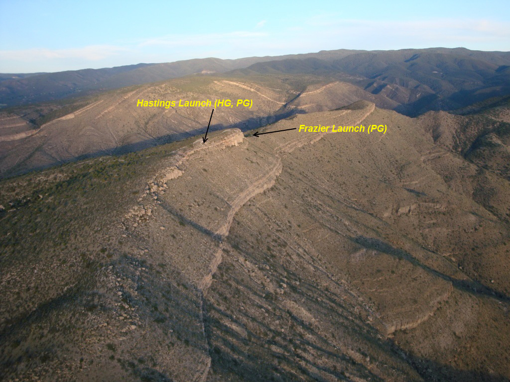
Robin Hastings launch (HG, PG) 32.927172° -105.885840° Alamogordo, NM 7,013' MSL
2,400' AGL
Bo Frazier launch (PG)32.925986° -105.883702°
Primary LZ 32.928334° -105.945127° (when not going XC, which is very common :) ) Minimum Glide Ratio 7.2 (Hastings launch) 7.8 (Fraizer Launch)
Bail Out LZ (emergencies only) 32.92772223793077°, -105.93997964498287°
Rated H/P3 or H/P2 with an USHPA instructor
present.
HA and TURB recommended
Robin Hastings Launch:
Hangies: ideal direction 200° - 270°, wind 10 mph gusts no more than 5 mph
Baggies: P4 recommended, ideal direction 230° - 270°, wind 10 mph gusts no more than 5 mph
Bo Frazier Launch:
Baggies only, ideal direction 200° - 235° (at launch, not synoptic), wind 10 mph gusts no more than 5 mph
Revised 20240107
In early March 2023, the Forest Service took a heavy 'dozer 2/3 of the way up the road to Dry and fixed the bad sections! It is now in the best shape it has been in since about 2016. That having been said, this is still a serious, steep, rocky jeep road that is NOT suitable for Outbacks, Foresters, RAV4s or similar SUVs. If you have a REAL 4x4 truck with high clearance, good tires and plenty of power, you will make it. Please do not spin out and make ruts. Use your crawl control or equivalent on the steep rough sections. Eventually, the road will deteriorate again as more and more ATVs and other off-road vehicles abuse it. Until then, enjoy!
General Info
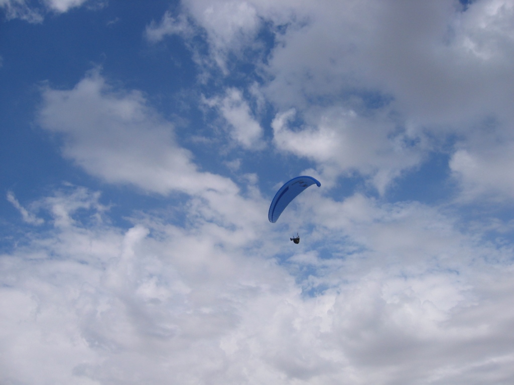
A premier world class site for PG and HG that has outstanding views of the Tularosa Basin, White Sands National Monument, the City of Alamogordo, and the Sacramento Mountains. The site was discovered and developed by the local hang gliding community many decades ago. We are very thankful for their pioneering work. Its southwest face and the bowl shape of the Canyon make for safe launching and ideal thermal and ridge soaring conditions. It is rare when pilots have a sled ride from Dry Canyon. Glass-offs and cross-country trips are regular features offered to pilots who fly Dry Canyon.
2021 Columbus Day Fun-Fly info
Some Videos
Dry Canyon RGSA SSA 2018 Memorial Day Fly-inDry Canyon Fly In 2020. 195 Mile XC. Alamogordo, NM to Conchas, NM
Dry Canyon Hangliding at the annual fly-in
Ozone Swift 5 - Dry Canyon mini-fly-in and mini-XC
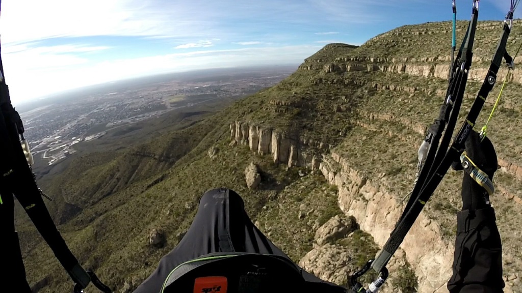
The main launch faces southwest over the Tularosa Basin and is at the center of a huge bowl formed by the Sacramento Mountains. View here is to the east with the 10,000' MSL summit of the Sacramento ridge in the far background.
 Steve Crye soaring the ridge in front of launch. Photo by Steve
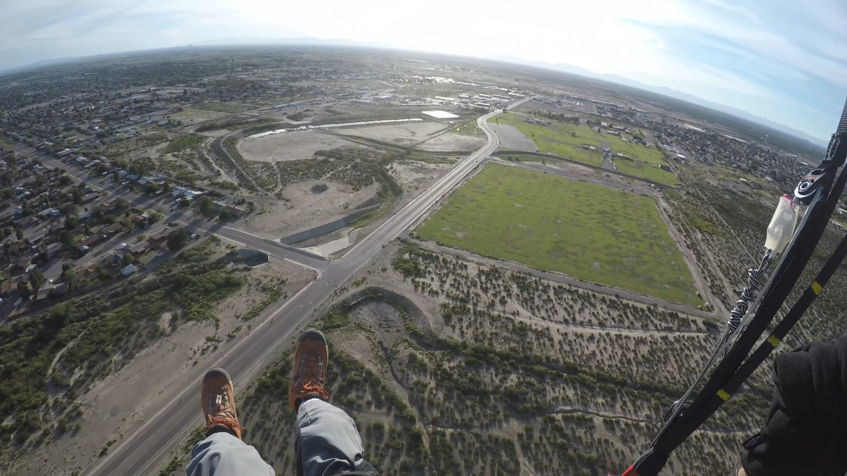
Main LZ
32.928334° -105.945127°
Ownership of the main LZ, aka "Hang Glider Park" aka Cox Field was transferred to Alamogordo Public Schools in 2021, because the plan was to build a midddle school there. However, public outcry, and a survey that showed the land was on a 100 year flood-plain, caused the deal to fall through and the land was deeded back to the City of Alamogordo in 2023. Sadly, the irrigation system was out of commission for almost two years, and the low "pipe fence" was removed, so the grass is dead and idiots have been doing donuts on the field. The RGSA is working with the City to preserve access and restore the irrigation.
Turn east off of HWY 70 (also HWY 54 and White Sands Blvd.) on
Fairgrounds road, go straight past the Griggs Field ball park to the landing
zone on the left.
HG pilots or PG pilots on EN B+ wings or better can easily make the LZ in a sled ride from
launch. PG pilots on an EN B- or below wing must have altitude greater than
the westerly part of the Dry Canyon ridge ("West Ridge") in order to make
the LZ in a straight glide, but often on the way to the LZ lift can be found along the ridge that runs down from launch. If you have reached the westerly part of the ridge and are still too low to make the Main LZ, Bail lOut LZ, or Optional LZ, immediately turn southwest and find something flat somewhere south of the Space Museum. Inexperienced pilots should
not land on the dirt road just south of the Museum as there are hazards in
the area including light poles and fencing. Less experienced pilots
can safely use the dirt road that spans the Canyon from northeast to
southwest and goes downhill nearly all of the way. It is a hike out
but there is over a mile of downhill sloping dirt road that is easy and safe
to land on. Do not attempt to land on the dirt road that goes
northwest – southeast at the base of the canyon. It is intersected by
deep washouts that are hard to see and would be dangerous to land in.
Bail Out LZ - emergencies only
32.92772223793077°, -105.93997964498287°
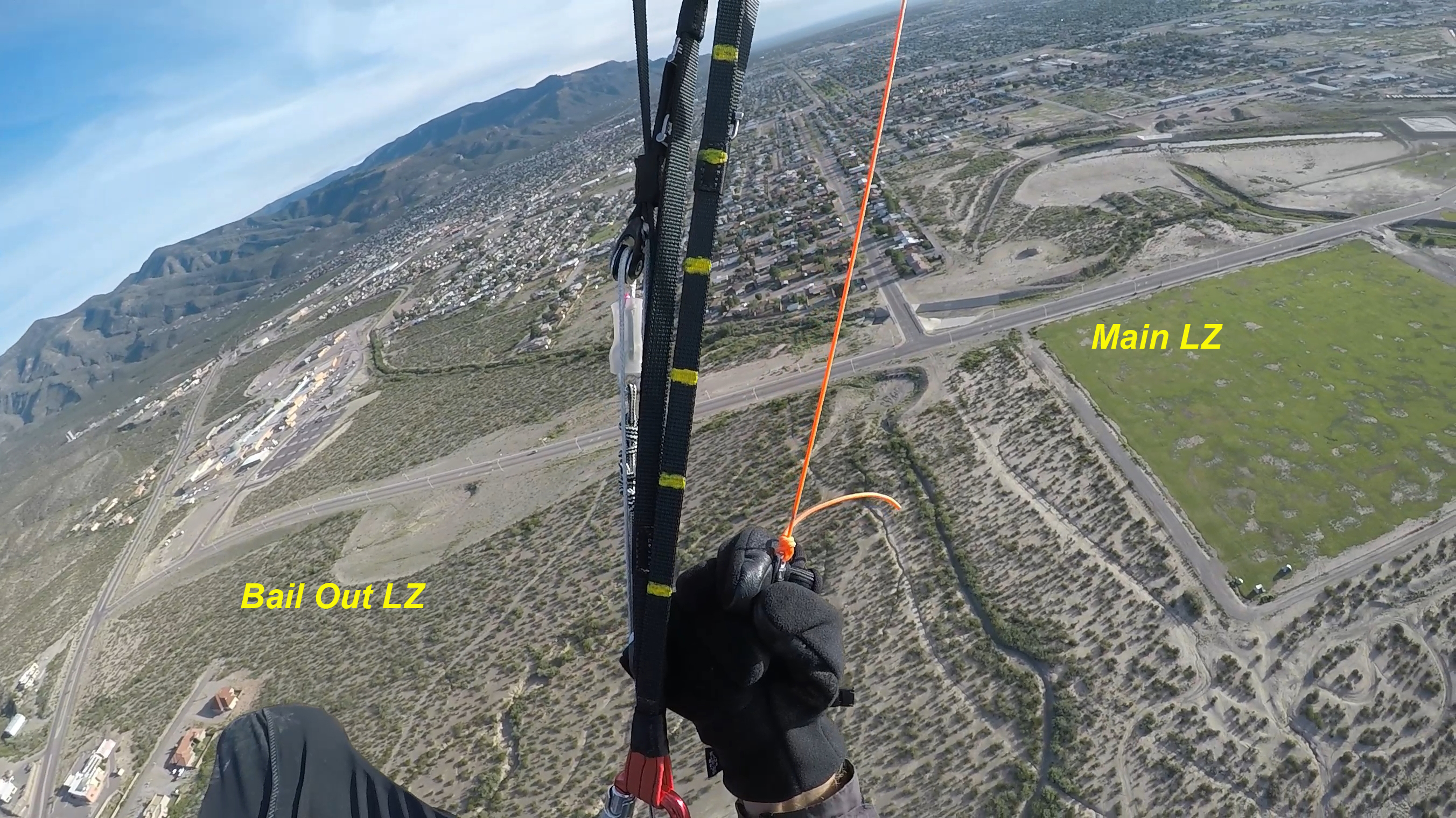
Just east of the primary LZ is a shallow drainage area. It is usually dry and not heavily vegetated. It is plenty big enough for PG, HG will require RLF skills and a cool head. Please only use in emergencies if you cannot reach the Main or Optional LZs. In general, do not land anywhere in the City of Alamogordo without prior written permission.
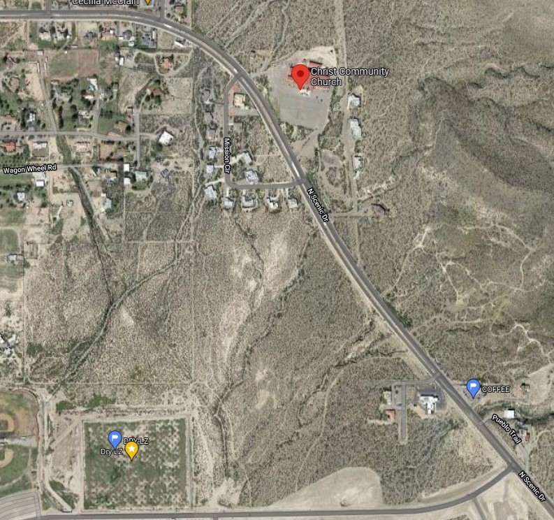
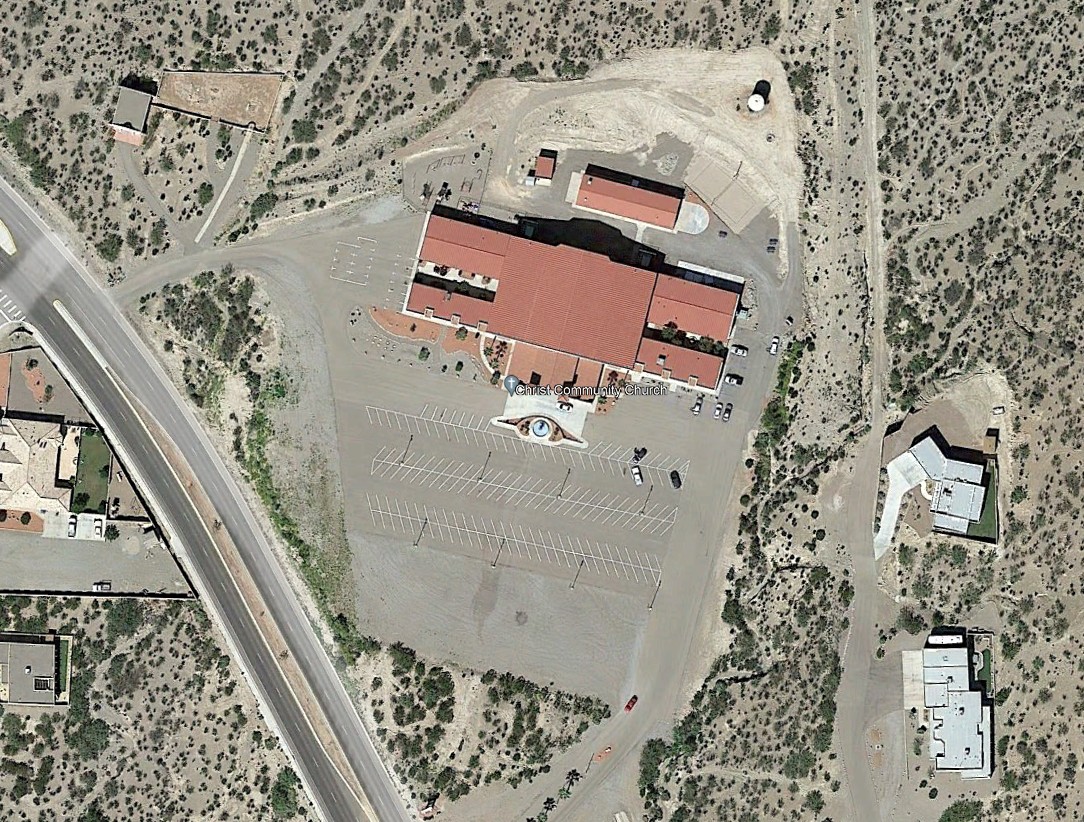
Optional LZ
The Christ Community Church on North Scenic Drive has a gravel parking lot below the paved parking lot that has been used in the past. Do NOT land if cars are parked there! Watch out for the light poles on the paved section of the parking lot. The dirt road behind the church will also work for PG.
Click for Directions to Launch
Restrictions
All pilots must contact the RGSA in order to use the landing zone. Only RGSA members and their guests may use the LZ per rules set by the City of Alamogordo. First time pilots should be guided..
Winds and Conditions
This is both a thermic and ridge soaring site, although the best flights use the amazing thermals that are common. Winds at the PG launch area are best when 4-12 mph. Above that, there is a danger getting blown over the back. HG, of course, can fly in much higher base winds but should not launch if winds are below 8 mph. Wind direction should be 240º - 270º. When winds start to turn more north, there can be very strong rotor near the ridge going out NW of launch. Pilots have been forced to the ground (side hill landing) by the rotor when winds were light from the north.
Thermals
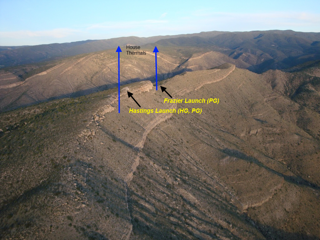
Dry Canyon has strong thermals that drift through the canyon and often merge near the launch area – making them more powerful. Pilots should be alert to turbulence when thermalling in this area, especially during the summer, and be careful to launch in conditions appropriate to their glider type and skill level. The house thermals are shown in the photo below. Pilots can expect 5m/s+ air in the middle of the day during the late spring, summer, and early fall seasons and even stronger rates near launch. The high pressure conditions that are common in the region often make the thermals sharp edged (punchy) with potentially dangerous lee side (downwind) turbulence. Unless you are comfortable and capable of handling glider deflations, we generally recommend that PG pilots stay out of the air from 10:30AM-4:30PM from April until October.
Launch Areas
There are separate launch areas for PG and HG.
We strongly recommend that PG pilots use the safer
Bo Frazier launch 270 meters southeast of the Robin Hastings HG/PG launch. The Hastings launch
is hazardous for PG for two reasons:
1.)
Rotor and turbulence are high because of the nearly shear cliff in front of the launch.
2.) There are many sharp rocks in the launch area which tend to snag the lines, even
cutting them on occasion.
PG: Launch into the direction of the wind, turn left (Hastings launch) or right (Frazier launch). Be sure to get out in front quickly. Keep a healthy 50 meters between you and the rocks. While the Hastings launch adds another 70' to launch altitude, it should not matter for PG.
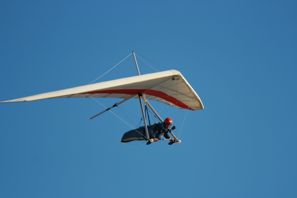
HG: Conditions will determine which direction HG pilots will turn when launching. Here is a good launch strategy (courtesy of Robin Hastings): If you go UP off the concrete ramp, turn left. If you go down, or straight out – turn right, and head for the LZ.
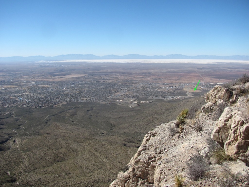
View just northwest from launch. The green arrow points to the primary LZ. Photo courtesy of Christopher Clemens.
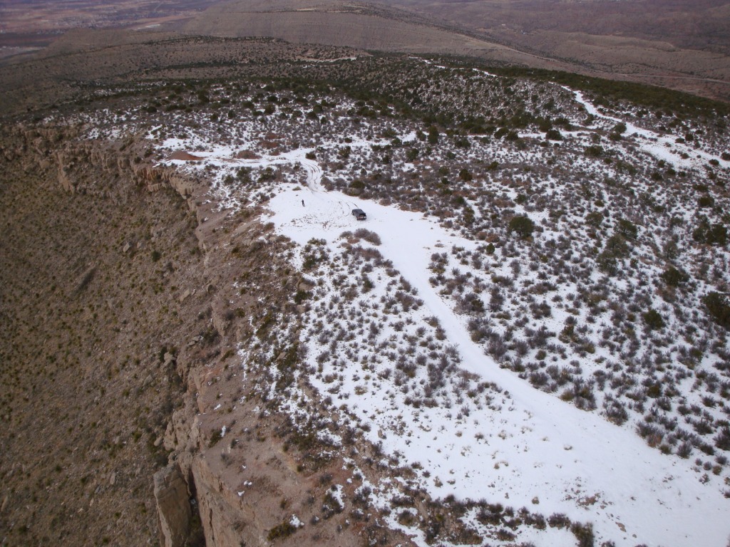
For PG pilots, flying during the late fall and winter is the ideal. Thermals are gentle and the ridge soaring conditions are delightful. Pilots can fly the ridge all day and enjoy a glass off above the city of Alamogordo. A dusting of snow can add to the enchantment of flying Dry Canyon.
Hastings launch area on January 27, 2010. Lee Boone is getting ready to launch. The LZ in Alamogordo was warm.
Additional Info &Hazards
Top landing (PG only) has now been done a number of times but it is only for experienced pilots. Rotor can be present! Again, TL is for experiences pilots only who can judge the hazards
Being blown over the back can be dangerous so pilots should always be watching their speed over the ground. The canyons behind the launch ridge are filled with tall pine trees and rocks.
Always watch the clouds east of launch and use caution if you see rain falling west of the Cloudcroft ridge - OD can build quickly!. Watch the weather while flying and be prepared to land immediately if overdevelopment begins. Weather dangers that are from the west can be observed by looking for the white sands kicking up in the air. Thank you, Robin Hastings, for this important tip.
If you look carefully in the photo below, you can see the effects of high winds on the Sands. They will kick up the white sands thousands of feet in the air. IF YOU SEE ANYTHING LIKE THIS, DO NOT LAUNCH/COME DOWN IMMEDIATELY as you are about to experience high winds.
Do not fly this site unless you have checked winds aloft as an occasional northwest breeze can swirl around and come straight in at launch but there will be rotor out in front, especially if you get lower than the ridge. Conditions in the Tularosa Basin can be checked by calling the automated weather service at the airport: 575-439-4112.
Dry Canyon launch areas & house thermals
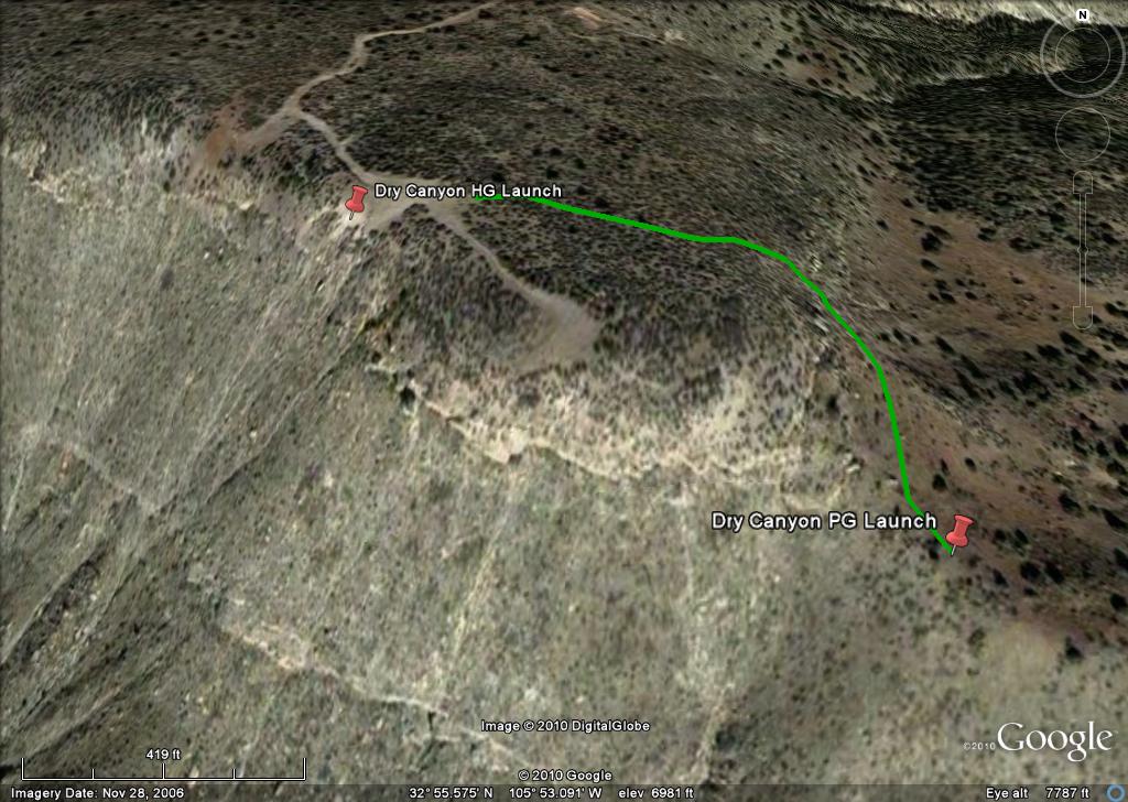
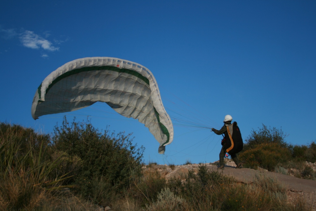
Below is a Google Earth image with path (green) to the Bo Frazier PG launch area. It is a short hike (270 meters.) around the back of the ridge and down a small cliff. PG pilots can safely lay out their wing with little rotor or turbulence and without the danger of snagging/cutting their lines. The path is fairly obvious but is not well worn as only pilots use it. The trick is finding the correct point to negotiate the short cliff about halfway down the path. The correct spot goes down the cliff in a narrow cleft. (Our thanks to Bo Frazier of the Sandia Soaring Association for his help and suggestions for using the PG launch.)
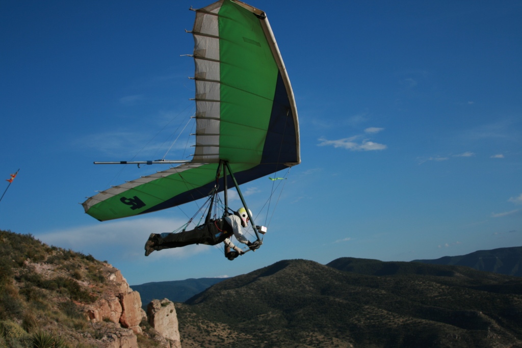
The late Robin Hastings just leaving his eponymous launch. Conditions at this moment were
mild as it was getting late in the day and Robin had a safe, easy launch.
Photo by David Sanderson.
A view of the Dry Canyon LZ. Grady Viramontes is kiting in the LZ. The City of Alamogordo was very generous when they cleared, seeded and irrigated this land back in the 80's. It is tragic that soon a school will be built there and we will be forced to find another LZ.
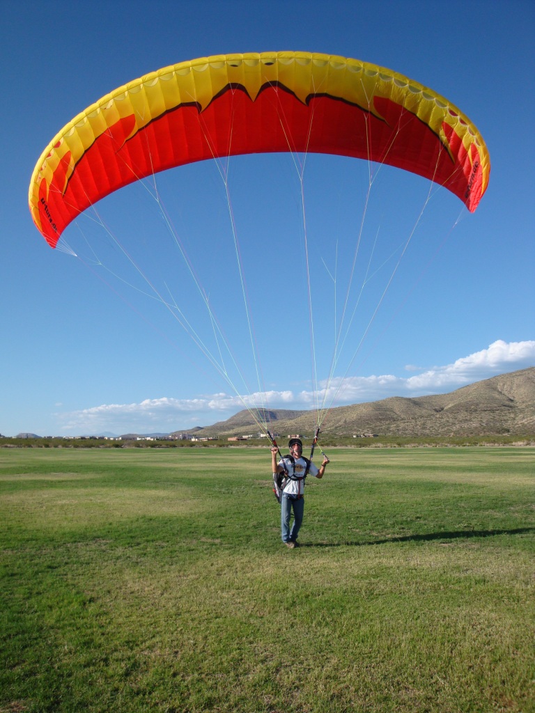
Grady Viramontes kiting in the LZ
Mike Ellsworth soaring off the face of Dry Canyon. Photo by David
Sanderson
A PG pilot bringing his glider up at the Hastings launch.
As evidenced here, the air coming in past the hang glider ramp is
turbulent at the south end which is why we recommend that PG pilots do not use this launch.
PG pilots should use the safer launch Bo Frazier launch 270 meters southeast of the Hastings
launch. Photo by David Sanderson
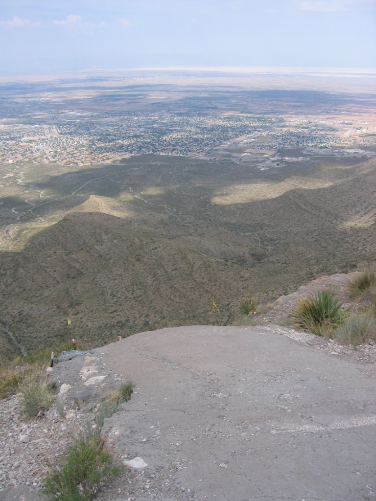
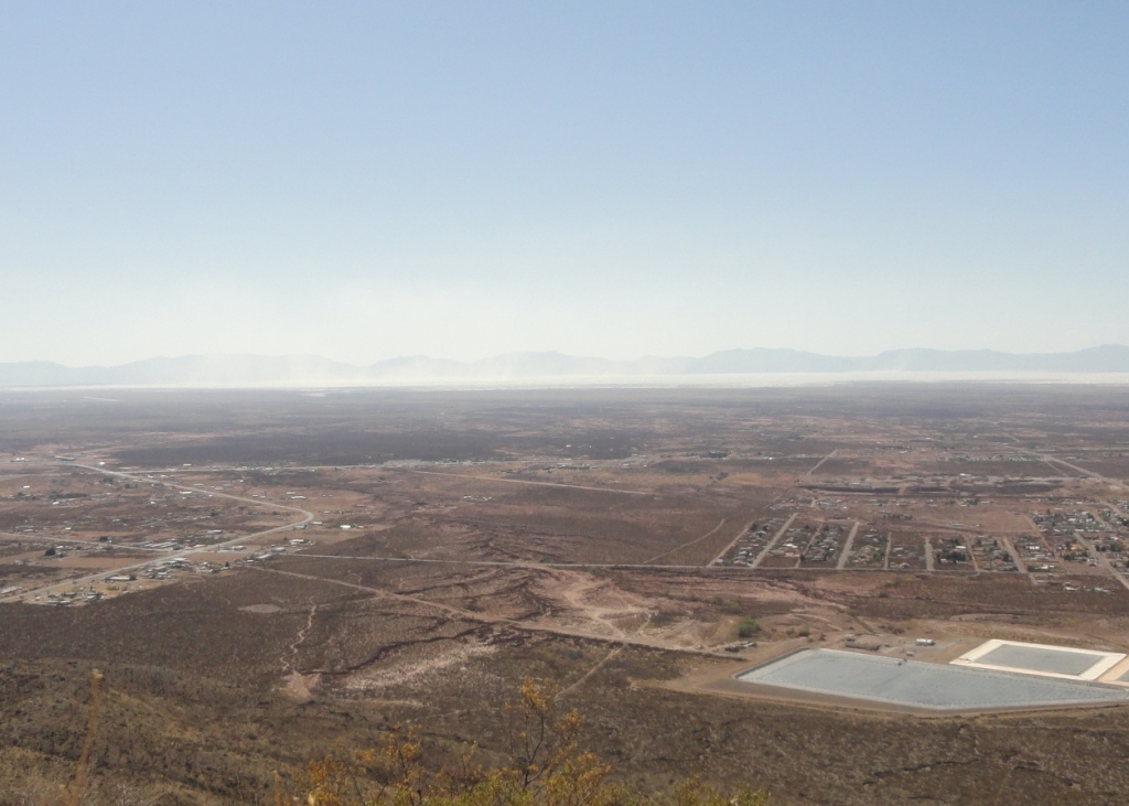
A view from the Hastings launch ramp (7,000') with the City of Alamogordo, NM and
the White Sands in the background.
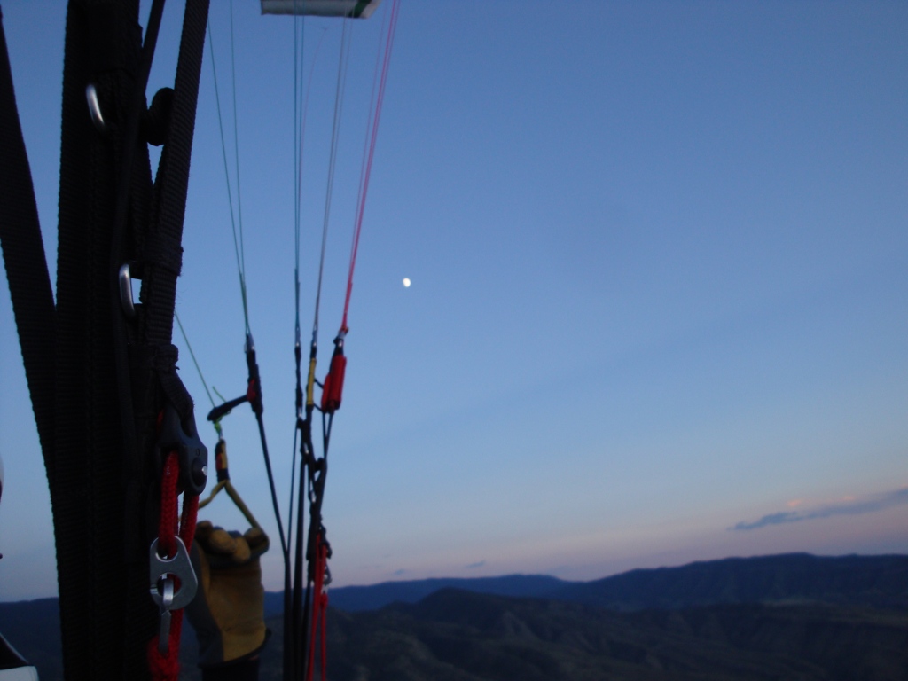
Soaring Dry Canyon late in the day. The white dot in the center is
the moon.
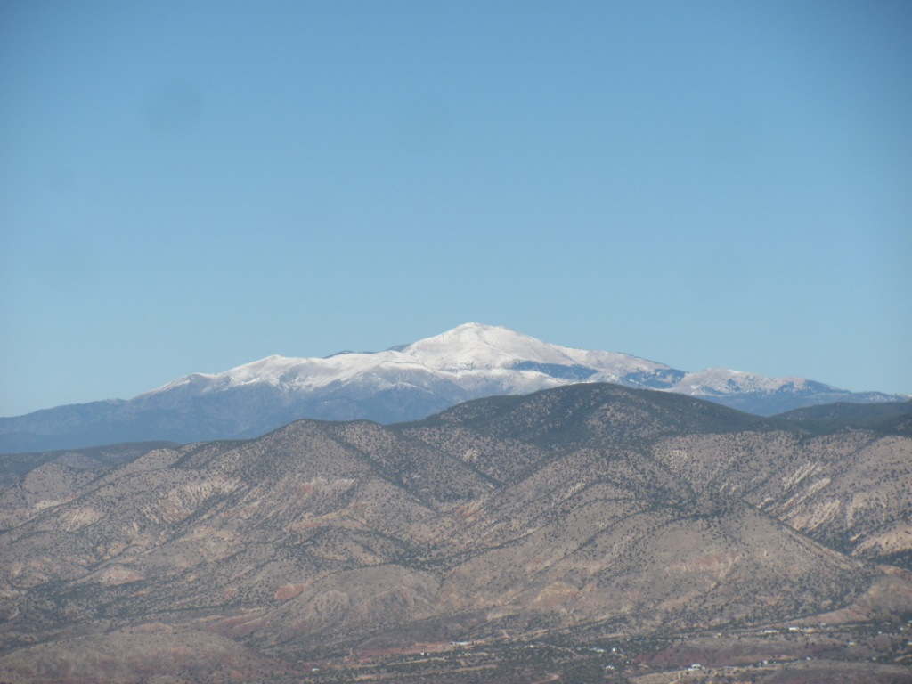
View of snowy Sierra Blanca 12,000' MSL looking north from the HG launch
area. Photo taken by PG pilot Christopher Clemens in late November.
Doak Hoover flying above the launch.